Being a Smart City is more than big projects for intelligent connected infrastructure: it’s also about engaging citizens in the life of their city. Local OpenStreetMap volunteers have been busy building a significant component of a Smart City.
Ever noticed how long it takes the giant online map providers to update their maps to reflect current reality on the ground? Shouldn’t a Smart City have an online map that changes almost simultaneously with changes on the ground?
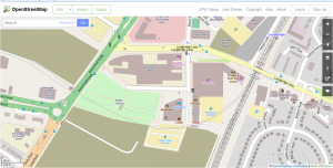
We’ve been busy mapping the redevelopment of the new urban centre of Longbridge arising from the rubble of what was the manufacturing centre for Rover. It includes a new town centre with retail space, residential areas, a new park, the relocated Bournville College, a new transport interchange and large industrial and office parks for local employment. Bournville College relocated there in 2011, there’s a Technology Park (opened 2007), an Industrial Park (opened 2008), hotel, bars, cafés and a Sainsbury’s supermarket (opened August 2013). A new park aptly named Austin Park runs through the centre of the development. Housing is going up at a rapid rate.
Luckily local mappers have the co-operation of the developer at Longbridge, St Modwen Group, which makes it easy for us to gain access and stay abreast of the development schedule. It also gives us an insight into the issues associated with assigning new road names and new postcodes and the ensuing mayhem for delivery drivers waiting for satnav systems to catch up.
So for most detailed and up-to-date maps of the new town centre, you need to use OpenStreetMap. We will be keeping pace with the development as it progresses. As we are an open data source we have NOT used any copyrighted plans or maps – we’ve done it all by survey and observation.
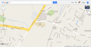
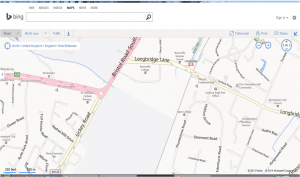
Here are views from February 2014 of Longbridge from Google, Bing, Ordnance Survey and OpenStreetMap (spot the best!):
Let me know when the others catch up!
This is an example of an open “citizen science” approach trumping large organizations with their complex processes and procurement of data from others. We’ve generated our own data – and we let you have access to the data not just the resultant map.
It would be great if all the developers carrying out work in Birmingham and the wider West Midlands could use us as a platform to get rapid inclusion of new streets and buildings as they are completed – for a truly Smart City approach to online mapping.


